New False Duck Island Lighthouse
Swetman Island, Ontario - 1965 (1828**)

History of the New False Duck Island Lighthouse
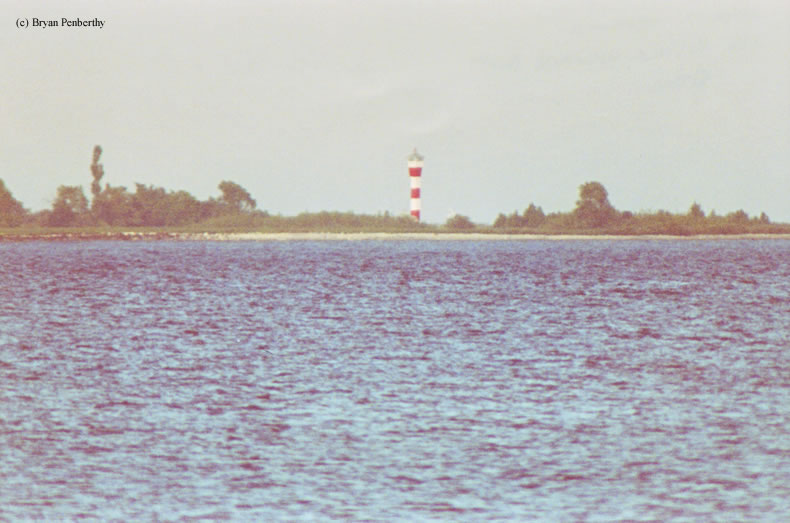
This is the "newer" False Duck Island lighthouse after the older one was torn down. This lighthouse is hexagonal looking more like an airport control tower. I am guessing close up it looks very similar to the Sullivan's Island Lighthouse in SC.
Note: When I first saw this light, I wasn't really too sure what it was. We spotted it out on an Island off the coast of Prince Edward Point Lighthouse. I could tell it looked like a lighthouse, so I snapped off a few pictures through my 1000mm telephoto lens. Searching through several books produced nothing until I looked through my Northern Lights - Lighthouses of Canada book by David Baird. It was shown in there. And in the brief write up it said The white tower has a conspicuous daymark of three red bands.
Directions: The lighthouse sits on False Duck Island which is anywheres from 1.5 miles off the coast of Prince Edward Point Lighthouse. The lighthouse is best viewed from the water, however, I used my 1000mm telephoto lens to get this photo.
View more New False Duck Island Lighthouse picturesTower Height: 62.00'
Focal Plane: 72'
Active Aid to Navigation: Yes
*Latitude: 43.94800 N
*Longitude: -76.79800 W
See this lighthouse on Google Maps.