St. Joseph North Pierhead Outer Lighthouse
St. Joseph, Michigan - 1906 (1832**)
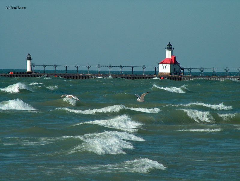

History of the St. Joseph North Pierhead Outer Lighthouse
A shore lighthouse originally was used at this location, but around 1850, a wooden pier was built. A lighthouse was used at the end to mark the entrance, but around the early 1900s, the pier was lengthened. A smaller lighthouse was built at the end turning this into a range light system. Both lighthouses are still active and still use their original Fresnel lenses.
Directions: From I-94 at exit 33, take business I-94 west to the end. Make a right and head north on Route 63. Make a left onto Klock Road, which will quickly change to Upton Road. Follow Upton to the point where it changes to Marina Drive. Follow Marina Drive to the end to Ridgeway Street. Make a left onto Ridgeway and follow that to Tiscornia Park.
View more St. Joseph North Pierhead Outer Lighthouse pictures
Tower Information
Tower Height: 35.00'
Focal Plane: 31'
Active Aid to Navigation: Yes
*Latitude: 42.11600 N
*Longitude: -86.49400 W
See this lighthouse on Google Maps.
Tower Height: 35.00'
Focal Plane: 31'
Active Aid to Navigation: Yes
*Latitude: 42.11600 N
*Longitude: -86.49400 W
See this lighthouse on Google Maps.