Racine North Breakwater Lighthouse
Racine, Wisconsin - 1901 (1900**)

History of the Racine North Breakwater Lighthouse
Posted/Updated by Bryan Penberthy on 2007-11-04.
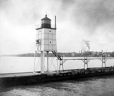 Racine Pierhead Lighthouse (Courtesy CG)
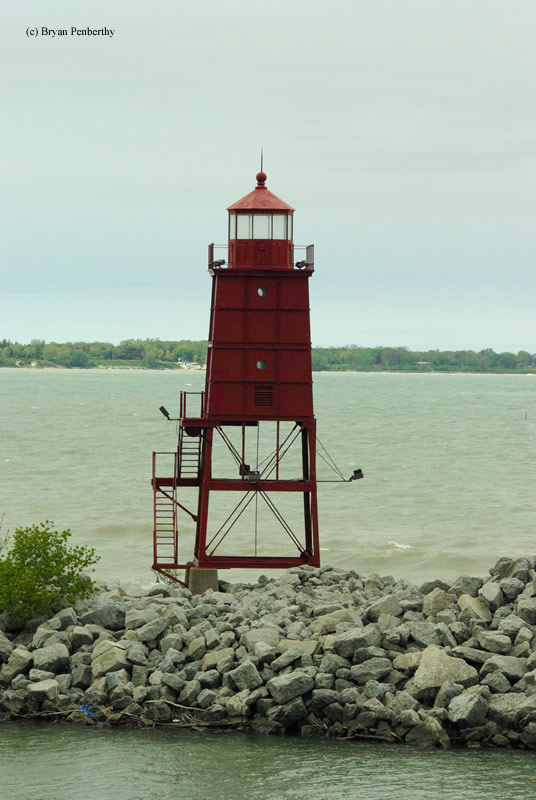
The current tower at the end of the north breakwater started life in 1901 as the north pierhead lighthouse. With the enlarging of the harbor completed in 1910, a new "pagoda style" lighthouse would be the first North Breakwater lighthouse. This tower would serve the location until 1930 when numerous harbor improvements took place in Racine. These improvements led to the removal of the north pier and the catwalk leading all the way back to the old Racine Harbor lighthouse. At this time, the pagoda style light was removed, with the replacement being the North Pierhead Lighthouse.
The North Breakwater Lighthouse was discontinued in 1987 in favor of a modern skeletal tower. It was going to be demolished, but public outcry saved it from demise. It is now the symbol of the city.
Reference:
- Great Lakes Lighthouses Encyclopedia, Larry & Patricia Wright, 2011.
- Wisconsin Lighthouses: A Photographic & Historical Guide, Ken & Barb Wardius, 2003.
- Lighthouses of Lake Michigan: Past and Present, Wayne S. Sapulski, 2001.
Directions: From Highway 32 (Main Street) in Racine, head east on Christopher Columbus Road into Harbor Park. Follow this to the end where there will be a parking area. This will allow you to get the best photos of the North Breakwater Lighthouse. Also in the same area is the Racine Harbor Lighthouse.
If you wish to walk out to the tower, park at the end of Barker Street. From here, you can follow the Lake Michigan Pathway out to the lighthouse.
Access: Grounds open. Tower closed.
View more Racine North Breakwater Lighthouse picturesTower Height: 46.00'
Focal Plane: Unknown
Active Aid to Navigation: Deactivated (1987)
*Latitude: 42.73400 N
*Longitude: -87.77200 W
See this lighthouse on Google Maps.