Queen's Wharf Lighthouse
Toronto, Ontario - 1861 (1838**)
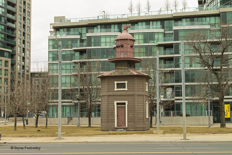

History of the Queen's Wharf Lighthouse
This light originally was the marker at the end of a pier at Bathhurst and Fleet streets in downtown Toronto. It was removed in 1929 when the pier was removed to change the waterfront.
Directions: From Downtown Toronto, take Lake Shore Blvd. east to where it meets Fleet Street. It is directly across the street from Coronation Park on Toronto's water front.
View more Queen's Wharf Lighthouse pictures
Tower Information
Tower Height: 20.00'
Focal Plane: Unknown
Active Aid to Navigation: Deactivated (1912)
*Latitude: 43.63587 N
*Longitude: -79.40490 W
See this lighthouse on Google Maps.
Tower Height: 20.00'
Focal Plane: Unknown
Active Aid to Navigation: Deactivated (1912)
*Latitude: 43.63587 N
*Longitude: -79.40490 W
See this lighthouse on Google Maps.