Port Dover Lighthouse
Port Dover, Ontario - 1846 (1846**)
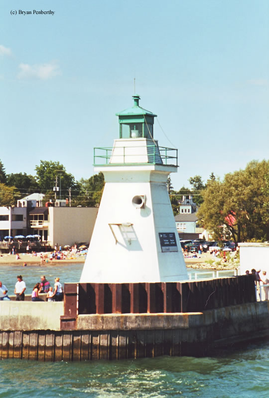

History of the Port Dover Lighthouse
Not exactly the biggest lightstation on Lake Erie, but pretty cool none the less. The tower sits at the end of a pier and flashes a green light. It also has an electronic fog signal that was sounding when we came back to port from our day trip. The tower had a part time keeper until 1979, it has since been automated. One particular event to note was that the lighthouse was struck by lightning in 1981 which caused a fire and considerable damage. The light has since been repaired.
Directions: From Route 6 (Main Street) in Port Dover, follow Main to Harbor Street. Follow Harbor Street to the end. The lighthouse will be at the end of the breakwall.
Access: The lighthouse is owned by Norfolk County. Grounds open. Tower closed.
View more Port Dover Lighthouse pictures
Tower Information
Tower Height: 28.00'
Focal Plane: 37'
Active Aid to Navigation: Yes
*Latitude: 42.78100 N
*Longitude: -80.20200 W
See this lighthouse on Google Maps.
Tower Height: 28.00'
Focal Plane: 37'
Active Aid to Navigation: Yes
*Latitude: 42.78100 N
*Longitude: -80.20200 W
See this lighthouse on Google Maps.