Point Cabrillo Lighthouse
Mendocino, California - 1909 (1909**)

History of the Point Cabrillo Lighthouse
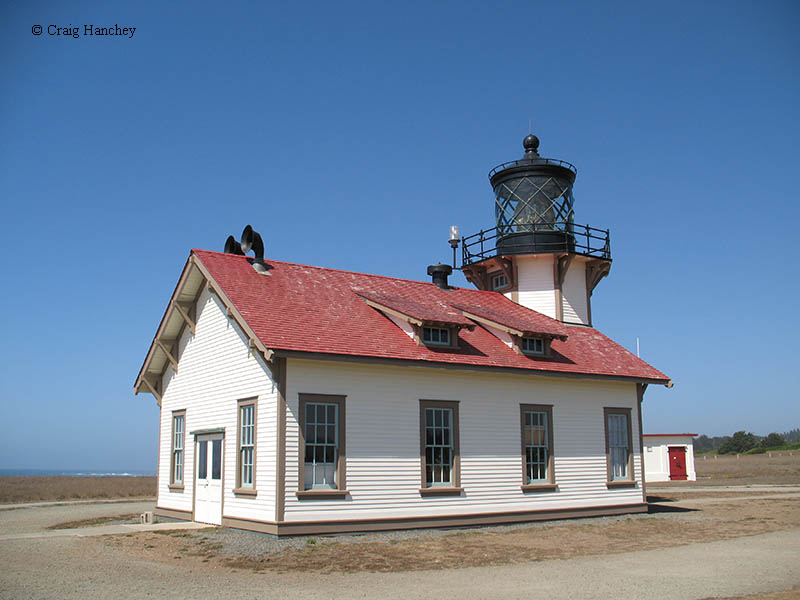
Due to major lumber operations in the area, the Government was petitioned for a lighthouse to mark the port. The Government agreed and built a Cape Cod style cottage with a tower on the back of it. The tower stood 47 feet tall, and housed a third-order Fresnel lens. Inside the building, gas engines powered the fog signals which stuck out the top of the roof facing the ocean. The lighthouse was automated in 1973, and the gas powered fog signals were decommissioned in the 1980s in favor of a sound bouy.
From what is written about the station, it was a highly sought after post. This was due to the location, the weather, and the fertile soil. However, one event in the station's history stands out, a major storm in February of 1960. From what I have read, the storm was so powerful that it pulled several ton boulders from the cliff and tossed them on-shore. Waves crested the cliff and slammed the doors at the rear side of the lighthouse. After a few hits by the waves, the doors caved in and flooded the bottom floor of the station. When the storm was over, the keeper soon discovered that the station's massive generator that was bolted to the floor had pulled up and was tossed against the opposite wall and there was a foot of sea gravel and sand on the station's floor.
Directions: From Highway 1 north of Mendocino and south of Caspar, you will make a left onto Point Cabrillo Drive. Follow this north for about 1.1 miles to the parking area. The lighthouse will be at the end of Lighthouse Drive. This road is closed to traffic, so you will have to walk the half mile to the light.
View more Point Cabrillo Lighthouse picturesTower Height: 47.00'
Focal Plane: 84'
Active Aid to Navigation: Yes
*Latitude: 39.34855 N
*Longitude: -123.82620 W
See this lighthouse on Google Maps.