Manistique East Breakwater Lighthouse
Manistique, Michigan - 1917 (1915**)
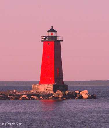

History of the Manistique East Breakwater Lighthouse
Built in 1915 to mark the entrance to the Port of Manistique. The tower is made of steel plates and stands thirty-five feet tall. It currently uses a 300mm plastic optic to send out its beam and was automated in 1969.
Directions: From US-2 in the Town of Manistique, enter Lakeview Park.
View more Manistique East Breakwater Lighthouse pictures
Tower Information
Tower Height: 35.00'
Focal Plane: 50'
Active Aid to Navigation: Yes
*Latitude: 45.94500 N
*Longitude: -86.24600 W
See this lighthouse on Google Maps.
Tower Height: 35.00'
Focal Plane: 50'
Active Aid to Navigation: Yes
*Latitude: 45.94500 N
*Longitude: -86.24600 W
See this lighthouse on Google Maps.