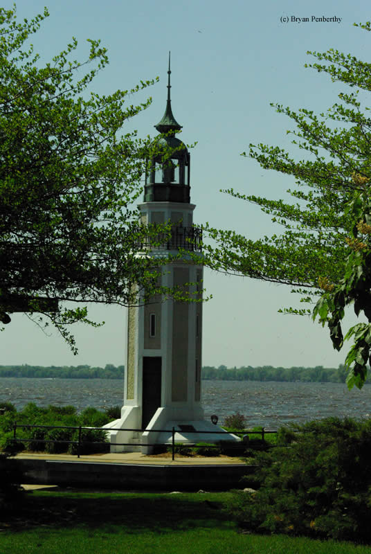
Bray's Point (Rockwell) Lighthouse
Oshkosh, Wisconsin - 1909 (1909**)

History of the Bray's Point (Rockwell) Lighthouse
Posted/Updated by Bryan Penberthy on 2007-12-02.
This lighthouse was built by former Wisconsin State Senator, William Bray, in 1909. After failing to convince the government of the need for a lighthouse at the point to mark the shallow dangerous reefs just off-shore, Mr. Bray used his own money to buy the land, construct the tower and pay for ongoing maintenance. He then assumed the role of keeper lighting the lamp each night. The plans came from Mr. Bray's friend, a noted architect named George Andrews Rockwell.
Once shipping traffic had increased on Lake Winnebago, the Federal Government finally realized the importance of the lighthouse. At this point, the government did assume the operating costs of the light. The lighthouse has been known by many different names over the years, which corresponds with the owners of the property at that time. Some of the past names include Bray (1909), Thompson (1918), and Buckstaff (1940s). It was also known as the Rockwell Lighthouse after the original architect.
The lighthouse was decommissioned in the 1950s, and fell into neglect. The neighborhood was renovated in the 1980s which allowed the tower to be better secured. The owners of the property then restored and re-lit the tower in 1986.
Reference:
- Wisconsin Lighthouses: A Photographic & Historical Guide, Ken & Barb Wardius, 2003.
Note: The lighthouse is on private property, please respect this and do not trespass.
Directions: The lighthouse sits on private property at the corner of Lake Street and Bay Shore Drive in Oshkosh. While heading north on Highway 45, head east on Ceape Ave. Follow this to the end, then head south on Lake Street. Follow Lake Street to the intersection with Bay Shore Drive.
Access: The lighthouse is on private property. Grounds and tower closed.
View more Bray's Point (Rockwell) Lighthouse picturesTower Height: 42.00'
Focal Plane: Unknown
Active Aid to Navigation: Yes
*Latitude: 44.00700 N
*Longitude: -88.51900 W
See this lighthouse on Google Maps.