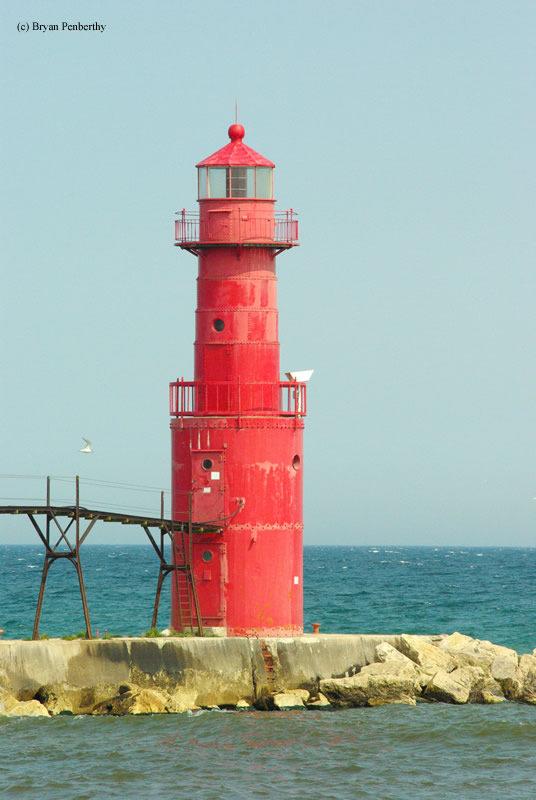
Algoma North Pierhead Lighthouse
Algoma, Wisconsin - 1932 (1893**)

History of the Algoma North Pierhead Lighthouse
Posted/Updated by Bryan Penberthy on 2010-07-24.
 Algoma Rear Range Lighthouse (Courtesy Coast Guard)
Algoma wasn't always the name of the community. Original settlers called the community "Wolf River" which was loosely based on the Indian word An-Ne-Pe. The spelling was eventually changed to Ahnapee, and the city continued to grow. It wasn't until 1879 that the city would become known as Algoma.
Some point during the late 1870s, the largest commercial fishing fleet on Lake Michigan was based out of Algoma. Having been denied official lights by the Federal Government, locals took the matter into their own hands and erected some lights on a post to be used to mark the entrance. In 1891, Congress approved the money for official lights for Algoma, which were built the following year. However, the lamps weren't lit until the beginning of the 1893 shipping season. The designs of the towers were such that the front range light was a lantern mounted upon a wooden pole and the rear was more of a traditional wooden tower mounted upon a set of skeletal legs.
Over the years, the light station did receive its share of upgrades starting with the lens being replaced with a fifth order Fresnel in 1895. Two years later, an elevated cat walk was installed to make accessing the tower in inclement weather safer for the keepers, which was extended to the shore in 1900.
Due to the ever worsening condition of the rear tower, it was replaced in 1908 using modern materials. What was installed at the site was a cast-iron tower standing twenty-six feet tall which made both previous range lights obsolete, and a new keeper's house which was built on shore. Improvements continued in 1910 when a fog signal was installed.
This would hold the station over until 1932 when it was deemed that twenty-six for the tower was not adequate enough. Rather than replacing the tower with a new one, engineers brought in a sixteen foot section, and placed the tower on that to bring the height up to forty-two feet. This was nothing new as other towers were heightened this way by placing a cast-iron tower onto a base, like the Rock Island Lighthouse in New York. At this time, the fog signal was upgraded to be run on electric rather than the 1910 compressed air system.
The tower is still an active aid to navigation, and is closed to the public. The tower was automated in 1973. At some point the fifth order Fresnel lens was replaced by a plastic optic.
Directions: From Highway 42 in Algoma, take Navarino Street east to the lake. The street will change names to Steele Street. The lighthouse sits out on a pier, but this is probably the best spot to view it.
Access: Grounds open. Tower closed.
View more Algoma North Pierhead Lighthouse picturesTower Height: 42.00'
Focal Plane: 48'
Active Aid to Navigation: Yes
*Latitude: 44.60700 N
*Longitude: -87.42900 W
See this lighthouse on Google Maps.
